

Note Friends: For a limited time (until April 4th, 2024), I’m running a fundraiser for a non-profit organization ’Planeterra’. Please help me support Planeterra by making a donation through my fundraising page.
Planeterra is a non-profit organization that supports multiple small communities worldwide by running various projects to empower the communities where G Adventure travels. More about Planeterra can be found on my page.
If you enjoyed reading this post and would love to make a small difference to the communities around the world. Even a small donation will help me achieve my goal! The process is fast, easy, and secure. Thanks so much for your support.
https://www.classy.org/fundraiser/5315896
Now back on to this post! Thanks & Cheers!
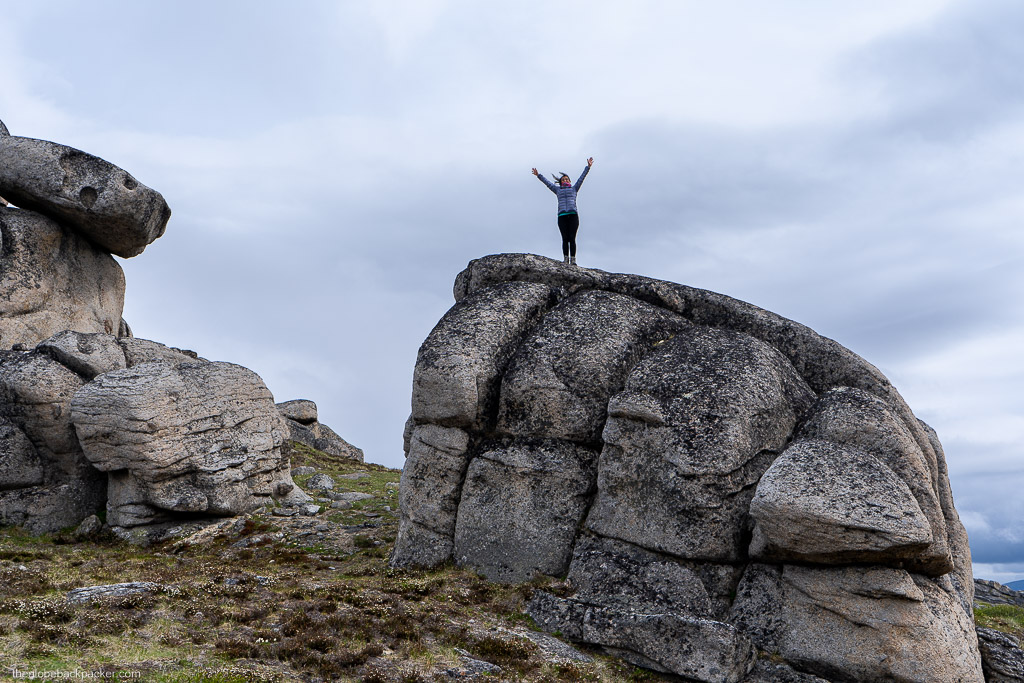
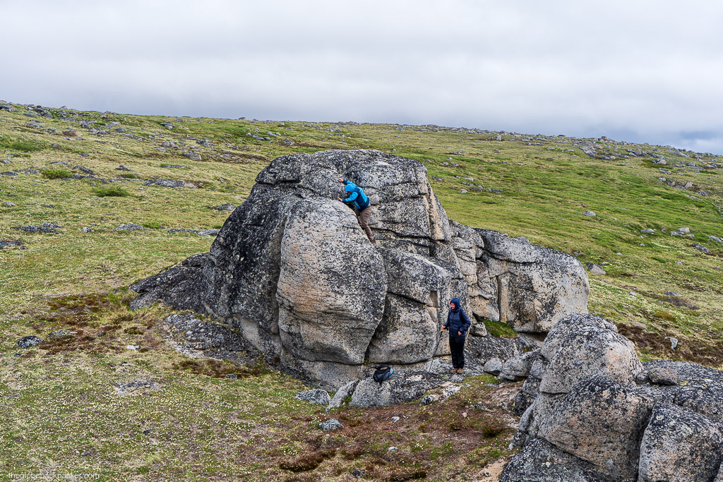
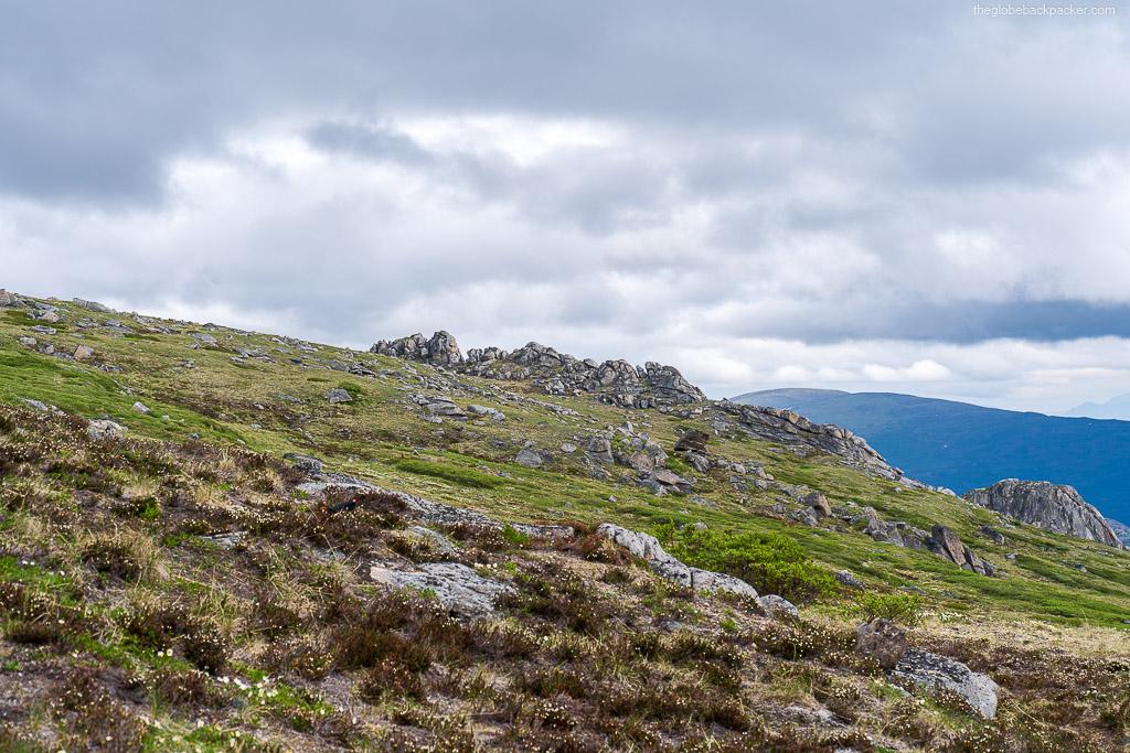
The Tors are located in Yukon, close to Whitehorse, and you can plan for a day hike in this region. As defined in Wikipedia, a Tor is a rocky outcrop on top of a hill which is formed due to erosions and weathering. You can read more about it here. They are fascinating to look at and there are multiple Tors on this hike for you to explore.
The hike can be completed in a few hours, and there are more than one sets of Tors on different hills. Based on how much time and energy you have, you may choose to explore more than one set of them.
| Type | In & out |
| Distance | 13 kms |
| Elevation Gain | 960 meters |
| Difficulty | Medium |
Trail Description
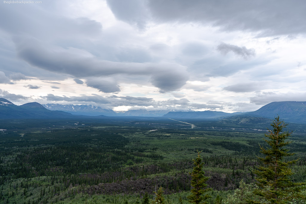
The trail begins near the turnoff right before the Otter Falls Cutoff. During most of the summer (unless it has rained a lot), you should be able to take your AWD/4×4 all the way in, to the actual trailhead on the fire break line. If this part of the road is muddy, you’ll need to park near the Alaska Highway and walk in, which should take about an hour more of walking.


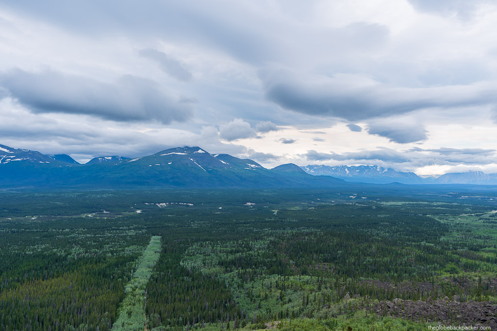
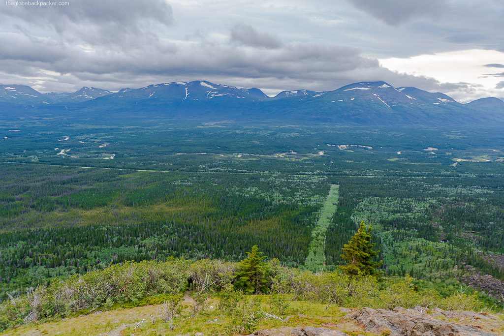
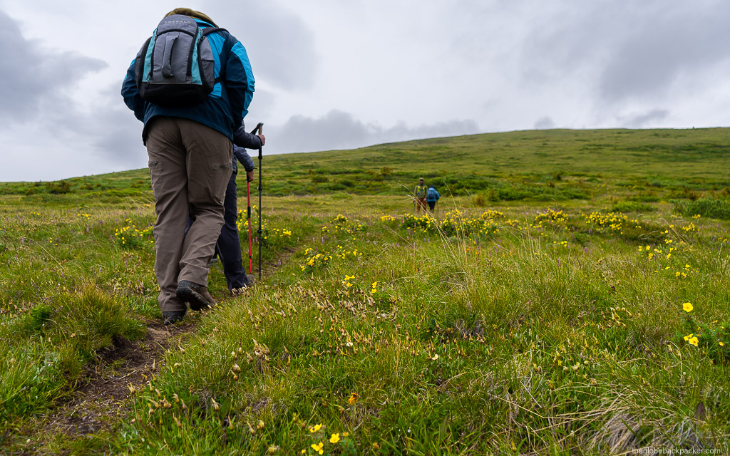
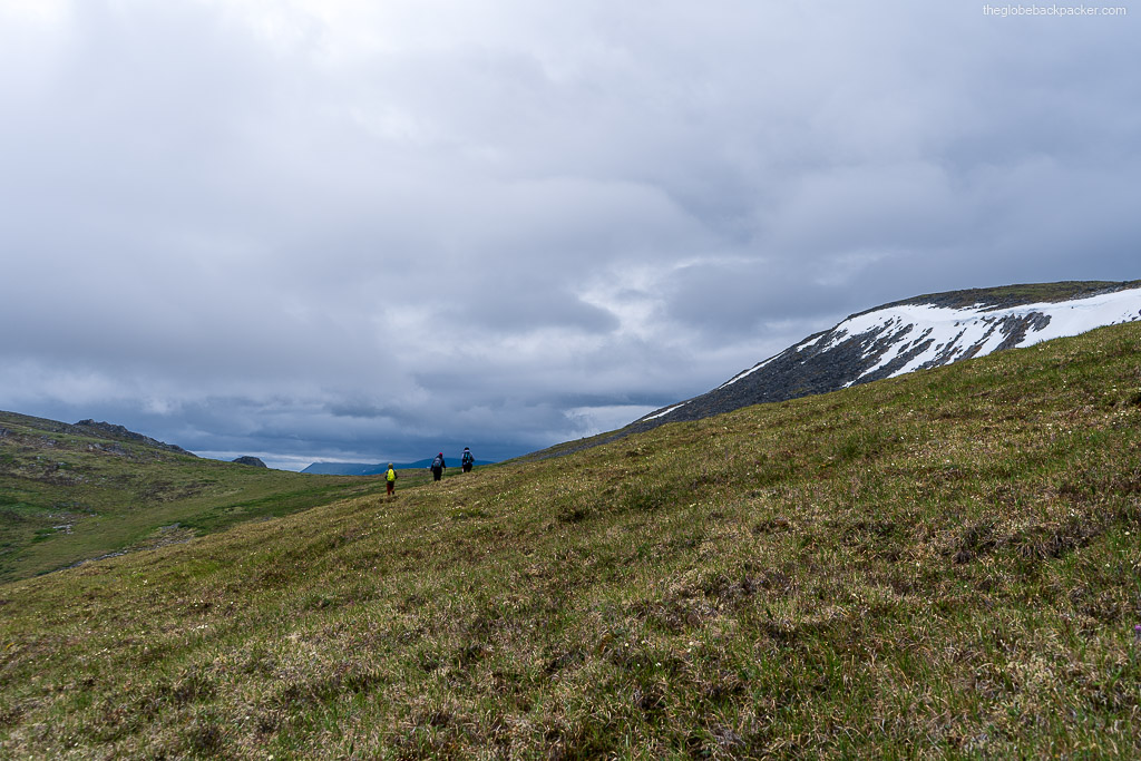
Follow the fire break line that follows straight up the mountain. This trail is also used by ATVs as well. Soon, you’ll begin to climb up steadily on the ridge. The fire break line behind you will become more obvious, the higher you reach. First part of the hike will take you near the top of the mountain.
From here, the trail splits and disappears in some spots. All trails eventually lead to the Tors. Near the top of the mountain, it is an open sub alpine terrain. It can get cold here, when the wind is blowing in the East-West direction.

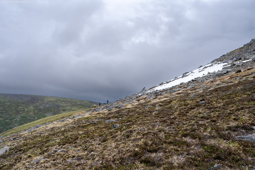
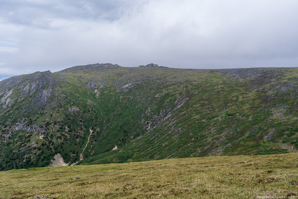
The trail skirts around the peak of this mountain from the left, on to the other side of the mountain. Once you reach the other side, you’ll see another mountain in front of you, connected by a saddle in between the two peaks. You’ll also see one set of Tors on the peak opposite to you. These ones are bigger ones, but to reach there, it’ll extend your hike by another 2-3 km.
You now continue towards the saddle, climb down the saddle and onto the other peak. Second set of Tors will be visible right in front of you.
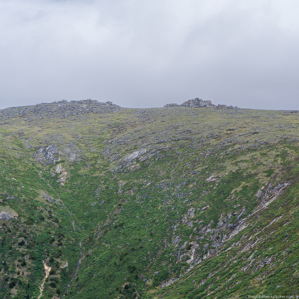

Once you’ve reached here, you can rest, and explore various Tors around you. You may also be able to climb on top of some rocks. There are many spots beneath the Tors to sit and relax, have lunch, with the protection from wind and a shade.
After exploring, you may trace back the steps to the trailhead or continue further to the next set of Tors.

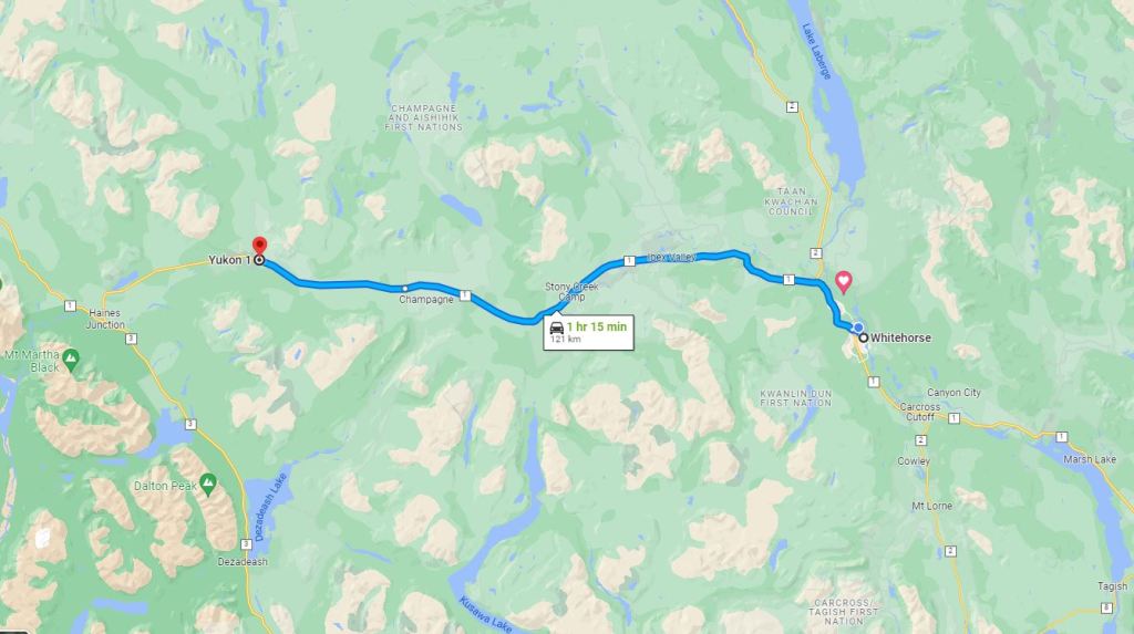
Driving Directions
The Tors are located near Kluane National Park in Yukon, few mins drive before Haines Junction.
It will take you about 1 hr 15 min drive by car from Whitehorse to reach to the trailhead. Check out the directions from Whitehorse by clicking on the map below.
Let me know if you’ve hiked this trail and how did you find exploring the Tors in the comments section below.
Cheers & see you on the trails!
