
Note Friends: For a limited time (until April 4th, 2024), I’m running a fundraiser for a non-profit organization ’Planeterra’. Please help me support Planeterra by making a donation through my fundraising page.
Planeterra is a non-profit organization that supports multiple small communities worldwide by running various projects to empower the communities where G Adventure travels. More about Planeterra can be found on my page.
If you enjoyed reading this post and would love to make a small difference to the communities around the world. Even a small donation will help me achieve my goal! The process is fast, easy, and secure. Thanks so much for your support.
https://www.classy.org/fundraiser/5315896
Now back on to this post! Thanks & Cheers!
| Elevation | 2,050 m |
| Elevation Gain | 1,426 m |
| Distance | 19 km |
| Type | Out & Back |

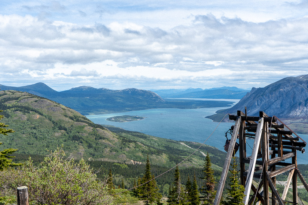
The Sam McGee trail is arguably one of the busiest trails in the Carcross region in the southwest corner of the Yukon. It is full of history and historical artifacts are still there all along the trail. The trail follows along the tramway built for silver mining in 1905.
There is also a high possibility of spotting wildlife on this hike – mountain goats, sheep and bears (both grizzlies and black). We had seen a sheep and a couple of mountain goats the first time we hiked in October 2019.

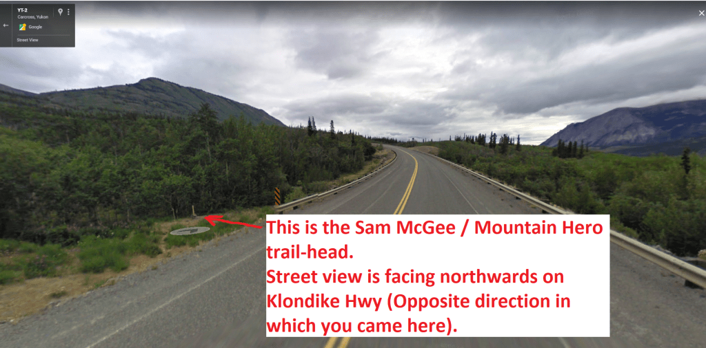
The trail head is located opposite to the Conrad campground, on the other side of the road (on your right if you are driving from Whitehorse). There is ample parking space at this campground.
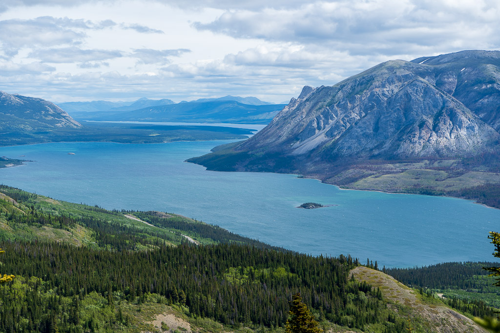
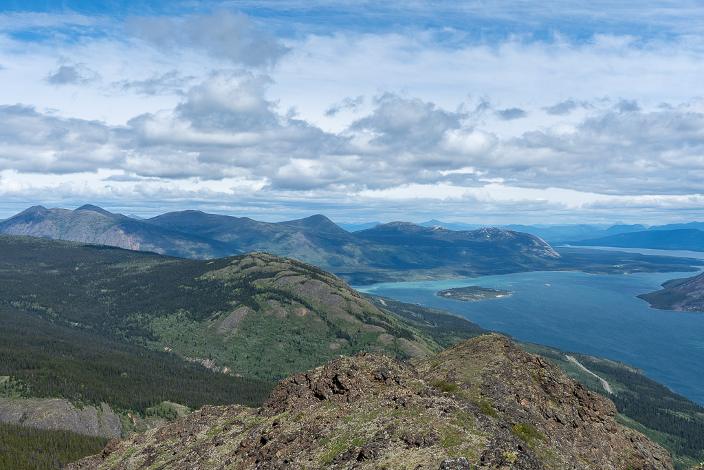
The trail begins with a gentle walk in the dense forest which gradually begins to get steep after ~1 km. After hiking for around an hour, you’ll reach high enough with occasional view points at the Tagish Lake below. From here onwards, the trees start to become scattered and berry plants (moss, blue, cran) begin to appear. Depending on the time of the year, you would find enough berries to substitute for a snack.
Soon enough, you will be in the alpine section and it is ridiculously windy here, any time of the day. When I say ridiculous, I really mean it!! Even during peak summer, a layered clothing system may be needed for hiking further up.
Very soon, you will see the trail forking in two paths – on the left is the small rocky peak where you will get expansive 360 degree views (we hiked this trail – it is also a part of the Mountain Hero trail) and on the right the Sam McGee trail goes further up adding another 4 km to the high point on the ridge.


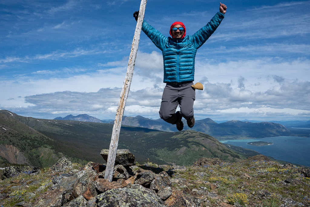
The shorter, left fork will take you to the highest point of the Mountain Hero trail. There is a marker at the highest point and from the peak, you’ll get panoramic views of the windy arm down below and snow capped mountains towards the south. The last section of the trail, up to the rocky peak, has some steep sections and loose rocks to scramble.


Total hike is approximately 12 km, and is considered difficult with about 1000 m of elevation gain. But, the views are worth it!!
Once you are satisfied and have loaded your camera with hundreds of pictures, begin descending back the same way you came up. Climbing down is the hardest part, especially on your knees. Bring a hiking pole with you on this hike, your knees will appreciate it after what feels like a long walk down.


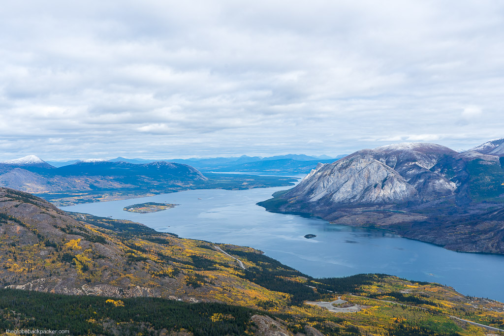


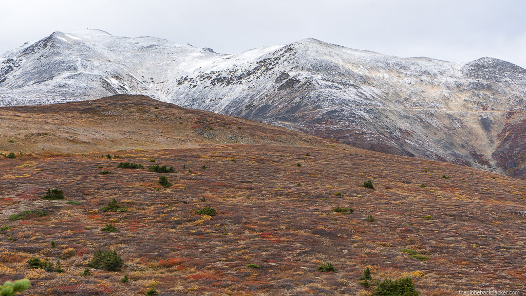
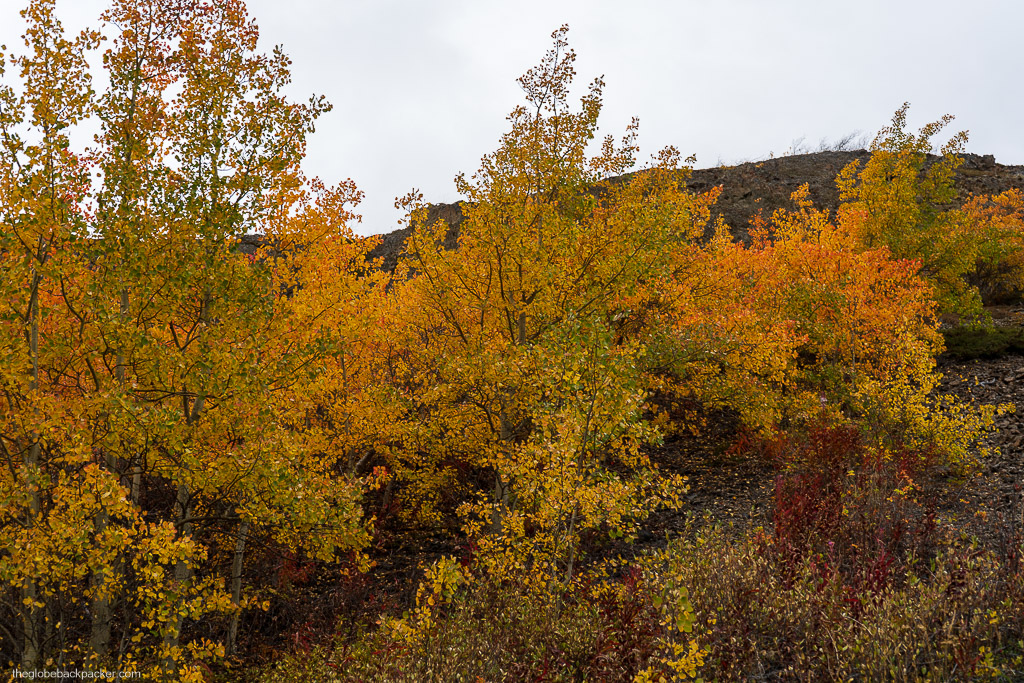
More Pictures (From the hike in the Fall season – September 2020)


Driving Directions
The Sam McGee trail is near Carcross, about 90 km from Whitehorse.
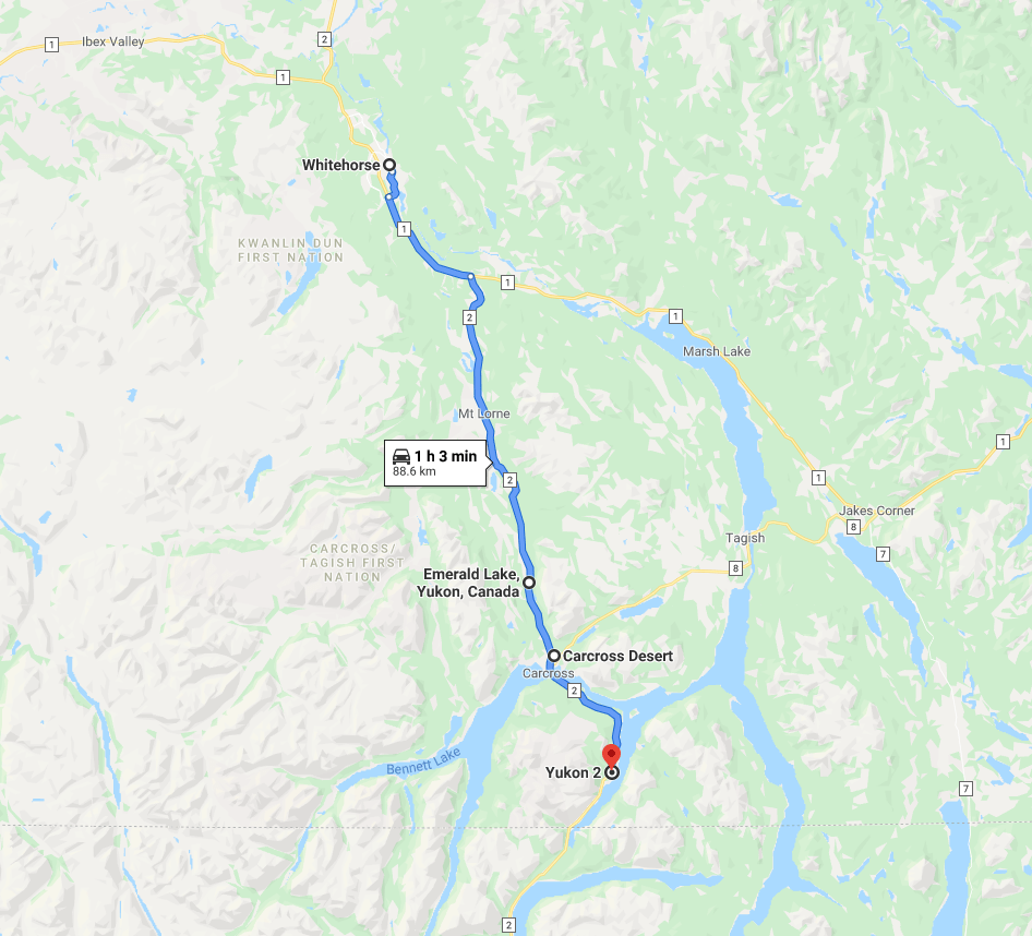
Get onto the Alaska Hwy and drive south for about 14 km then turn right on Klondike Hwy. Continue on Klondike Hwy for another 40 km and you will pass Emerald Lake on your right. There is a look out point to take pictures of the emerald blue color lake. After driving for another 10 mins, you will pass Carcross Desert (North America’s smallest desert) on your right. Continuing further, you’ll pass a small town of Carcross. Continue on Klondike Hwy for another 17 km and you’ll see the Conrad Campground on your left. There is ample parking space at this campground and the trailhead is on the opposite side of the campground as shown in the picture below.
For more things to do in Carcross, check out my post on the Carcross desert by clicking here.
Have you hiked the Sam McGee trail? Share your feedback & pictures in the comments section below.

2 responses to “Hiking the Sam McGee Trail in Carcross, Yukon”
[…] Check out the bright shades of yellows, oranges & reds during the Fall season here. […]
LikeLike
[…] For more things to do in Carcross, click on the following link for more information on hiking the Sam McGee Trail. […]
LikeLike