Note Friends: For a limited time (until April 4th, 2024), I’m running a fundraiser for a non-profit organization ’Planeterra’. Please help me support Planeterra by making a donation through my fundraising page.
Planeterra is a non-profit organization that supports multiple small communities worldwide by running various projects to empower the communities where G Adventure travels. More about Planeterra can be found on my page.
If you enjoyed reading this post and would love to make a small difference to the communities around the world. Even a small donation will help me achieve my goal! The process is fast, easy, and secure. Thanks so much for your support.
https://www.classy.org/fundraiser/5315896
Now back on to this post! Thanks & Cheers!
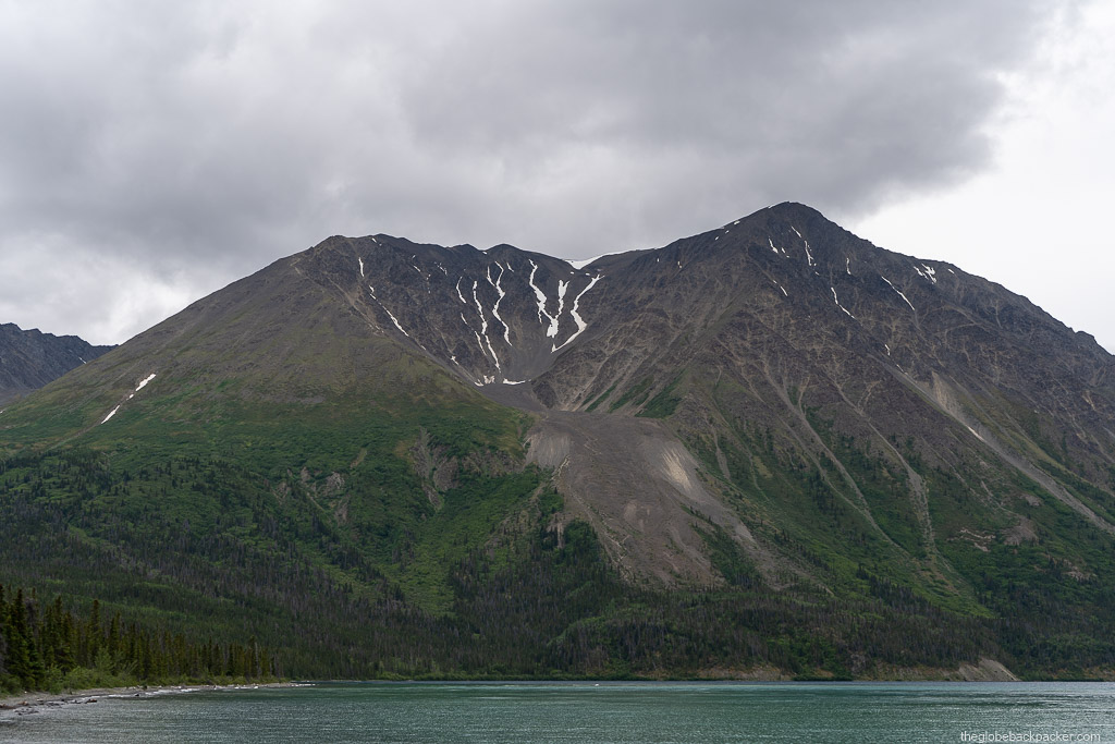
The Kluane National Park is located in the southwest corner of the Yukon Territory. It shares its border with two other parks – Tatshenshini-Alsek Provincial Park of British Columbia to the south and Wrangell-St. Elias National Park & Reserve of Alaska, USA to the west. These parks contain the largest non-polar icefield as well as some of the most spectacular glaciers in the world. Together, these three parks are recognized as a UNESCO World Heritage Site.
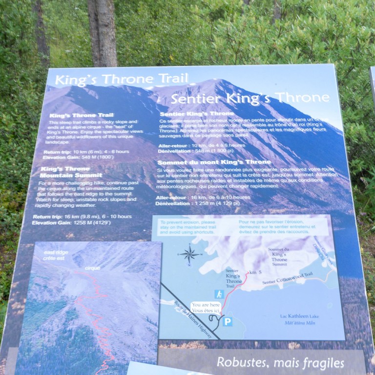
There are many outdoor activities to do in Kluane NP, one of which is hiking. King’s Throne Mountain is a very well known peak to hike within the park. It is a towering mountain on the shore of Kathleen Lake and is easily recognizable from a distance. The hike is so highly rated among Yukoners that it is often said “You are a true hiker only if you have hiked King’s Throne!”
| Type | Out & Back |
| Distance | 12.7 km |
| Elevation Gain | 1,374 m |
| Total Elevation | 1,990 m |
| Rated | Difficult |
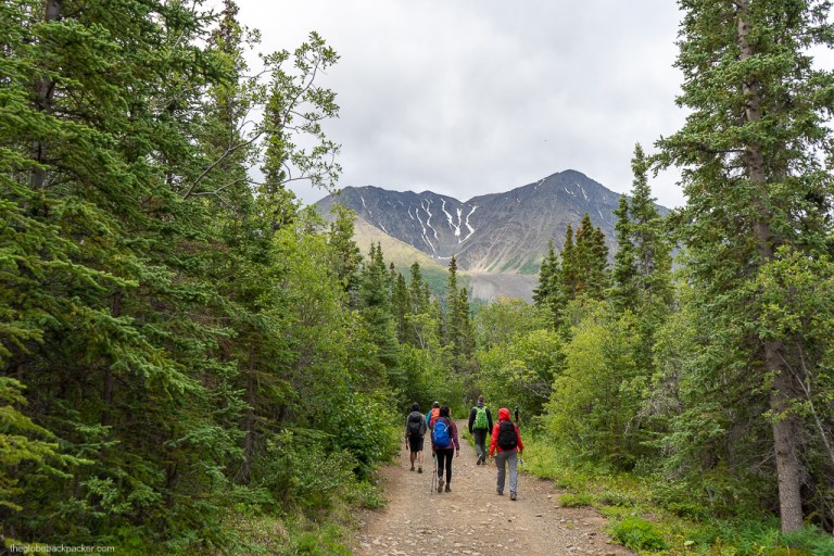
The trailhead is located near the Kathleen Lake day use area. From the parking, follow the trail until you reach the first of the two forks. There is a sign board here indicating ‘King’s Throne/Cottonwood Trail’ to the left and ‘Kathleen Lake’ to the right. Continue left, which will take you to the base of the mountain. Up until here, it is a flat trail passing through dense forest. The mosquitoes are so big and large in number that you will think of turning back.
Continue further and very soon you will reach second fork, indicating King’s Throne Trail is on the left and the Cottonwood Trail on the right. Continue on the trail to the left, which begins to steadily climb upwards.

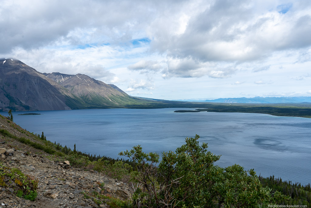
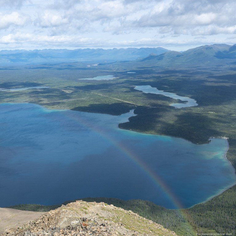
After around 45 minutes, you will reach above the treeline on an alpine rocky trail. Above the treeline, there’s a constant view of the Kathleen Lake behind. As you’ll climb higher and higher, over a series of switchbacks, sweeping views of the entire lake will start to appear.

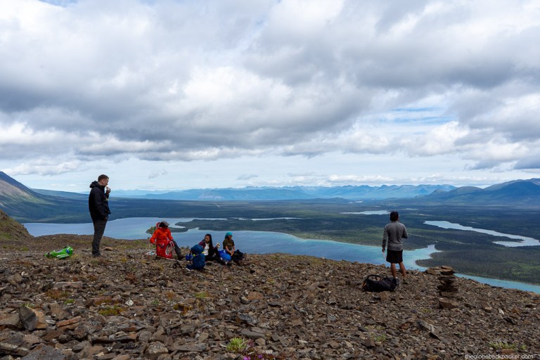
Continue climbing up, until you reach the alpine cirque – the “seat” of the King’s Throne. This is a very obvious spot and is hard to miss. For many, this is the end point of their hike up.

Those who intend to continue upwards on a steeper climb to the summit, this is a good place to stop for lunch. Make sure you rest and consume enough calories before heading further up. Every single bit of your energy will be necessary for the remaining half of the climb.

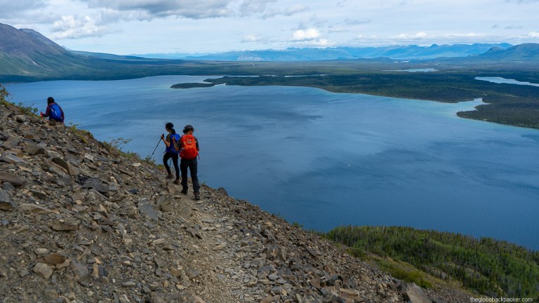
Remaining 2.7 kms are the toughest section of the hike. It gains an elevation of 740 m! It is an extremely steep climb on loose rocks and gravels. Trekking poles are a must for this part of the hike. Some portions of the trail require rock scrambling as well.
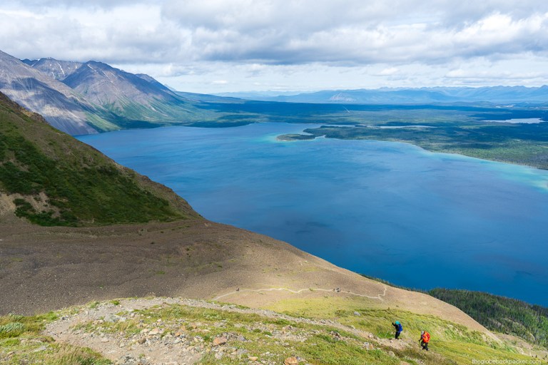

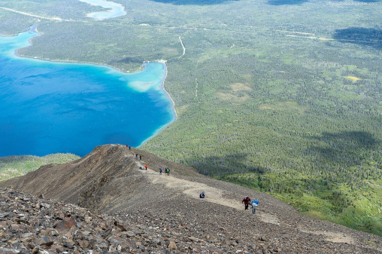
There are 2 summits on this mountain. First, there is a false summit at 1.7 km from the cirque at an elevation of 1,920 m. The true summit at 1,990 m is another 1 km away from the first summit.

But, the final one kilometer is a relatively flat hike on an exposed ridge, as shown in the image below.

Unfortunately, it was extremely windy on the day we hiked, with gusts well over 100 kmph at this elevation. It was nearly impossible to even stand facing against the wind. Most of the time we kept ducking behind the rocks, as seen in the picture below, to prevent ourselves from getting blown away!
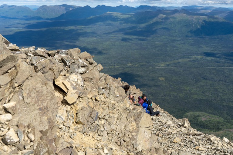


Due to the relentless wind, we decided to turn back from the first summit. It was not safe to continue further, and risking our lives by walking on an exposed ridge. As Ed Viesturs famously quoted – “Getting to the top is optional. Getting down is mandatory.”


Climbing down is no walk in the park. In fact, it is more difficult on the knees to climb down on steep trails with loose rocks than climbing up. But, the panoramic views in front of you make it all worth it. Also, you can see humans all along the trail, like small ants, going down in a single line.

As you continue climbing down, the mountain looms large over you and the trail seems to go on endlessly.


After, what seems to be like a very long hour of hiking/sliding down, you will finally reach back to the “seat” of the throne. Take in the views for one last time before heading further down, below the treeline.


The last 4 kms are very boring as there are no more views to soak in, you are exhausted and the mosquitoes are back! But, slowly and steadily, keeping one foot in front of the other, you will eventually reach back to your car.
Finally, it’s time to celebrate and high-fiving on finishing one of the most challenging day hikes in Yukon. You may choose to drive back to Whitehorse or camp for the night at Kathleen Lake campground which is only 2 minutes from the trailhead where you’re parked.
The campground has 39 sites and you may want to book a site in the morning before beginning the hike as it gets filled up pretty quickly. On returning back from the hike, I found that someone had stolen my spot and set up their tent. Hence, I had to move to another spot, which I was very lucky to get. In another hour, all the sites were booked. Learning the hard way, another tip is to set up the tent and then go for a hike.

Kathleen Lake day use area/Kathleen Lake shore is only 5 minutes from the campground and is a great spot to stretch your legs, sip a well earned beer and gaze at the mountain you were on just a few moments ago.


For more things to do in the Kluane National Park, check out my post on Whitewater Rafting in Kluane here.
Driving Directions
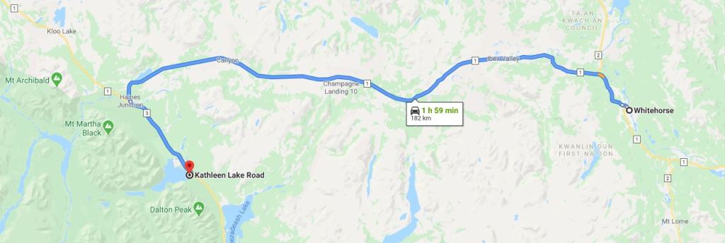
King’s Throne trailhead is about 180 km from Whitehorse. It is very close to the Kathleen Lake shore in Kluane National Park.
Get on the Alaska Highway and continue until Haines Junction. From Haines Junction, get onto the Haines Highway and continue for another 26 km. You will see a sign to turn right for Kathleen Lake. Take right and continue for another 1 km where you will see a large parking area. On your left is the trailhead and on the right is the Kathleen Lake shore.
Note: Kluane NP is a bear country. Both, black and grizzly bears call it their home. Respect the wildlife, and store your food properly. Do not leave any trace on the trail as well as in campgrounds. Make sure you have bear bangers and bear spray with you all the time.
If you have hiked King’s Throne before, share your experience by commenting below. Also, if you are planning to do this hike and have any questions, write in the comment section below.

2 responses to “Kluane National Park: Part 2 – Hiking King’s Throne Peak”
[…] I highly recommend this hike to any seasoned hiker on their trip to the Yukon. Check this post to see why King’s Throne hike is one of the favorites of many Yukoners here. […]
LikeLike
[…] For more things to do at the Kluane National Park, check out my post on hiking King’s Throne Peak here. […]
LikeLike