

Note Friends: For a limited time (until April 4th, 2024), I’m running a fundraiser for a non-profit organization ’Planeterra’. Please help me support Planeterra by making a donation through my fundraising page.
Planeterra is a non-profit organization that supports multiple small communities worldwide by running various projects to empower the communities where G Adventure travels. More about Planeterra can be found on my page.
If you enjoyed reading this post and would love to make a small difference to the communities around the world. Even a small donation will help me achieve my goal! The process is fast, easy, and secure. Thanks so much for your support.
https://www.classy.org/fundraiser/5315896
Now back on to this post! Thanks & Cheers!
Samuel Glacier is located in Tatshenshini-Alsek Provincial Park in British Columbia. The park lies in the northwest corner of British Columbia. It is located between Kluane National Park and Reserves in the Yukon and Glacier Bay and Wrangell-St. Elias National Parks and Preserves in Alaska. It is recognized as a UNESCO World Heritage Site. The park got its name from two of the great river systems on the planet – Tatshenshini River and Alsek River.
Since, the park is so remote, much of it is still unexplored and there are very limited facilities available within the park in the form of pit or flush toilets (only three in the entire park). It is home to big mountains and numerous glaciers, some of which are yet to be named. The park also contains a diverse wildlife population consisting of mountain goats, Dall sheep, grizzly bears, black bears, moose, squirrels, marmots, eagles, gyrfalcons, peregrine falcon, ptarmigan, arctic tern and many more bird species. There is one type of black bear, which is found only in this park and nowhere else in Canada or Alaska, called the ‘Glacier bear’. It got its name from its bluish colored hair.
Many outdoor adventure enthusiasts frequent the park for various activities like canoeing, kayaking, rafting, hiking, mountaineering, mountain biking and fishing. Wilderness, backcountry camping is permitted, but there are no campgrounds or any other camping facilities available in the park.
Among numerous glaciers within the park, the Samuel Glacier is easily accessible from the Haines Highway through a 21 km Samuel Glacier Trail.

| Type | Out & Back |
| Distance | 21 km |
| Elevation Gain | 167 m |
| Difficulty | Moderate |
| Time | 1-2 days |
Despite its length, this is a moderate trail because it is relatively flat. It is popular as a 2 day backpacking trip; with overnight camping at the viewpoint of the glacier. Those who are short on time or not interested in backpacking, can also do it as a long day hike.

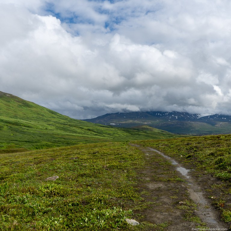
The trail begins from a pullout on the Haines Highway, about 140 km south of Haines Junction. It is a newly developed pullout with ample parking space and an outhouse. Detailed driving directions are provided at the end of this post. Most of the trail is on an open, subalpine boggy terrain with some sections passing through heavy bushes, some of which are as high as 7 feet. Because of the dense, tall bushes, it is not recommended to hike solo on this trail, as bears as close as 5 feet from you may be hidden from your view.

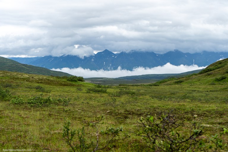
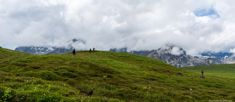
The trail begins with a gradual climb up a small hill with the otherworldly landscapes on either side.

Behind, there is the Kusawak Peak on the other side of the highway.
Continuing further, about 2 km in, bushes begins to appear. For some sections, they are so dense that you’ll have to crouch, bushwhack and walk through deep mucky spots due to heavy and long periods of summer rains in this part of the country.

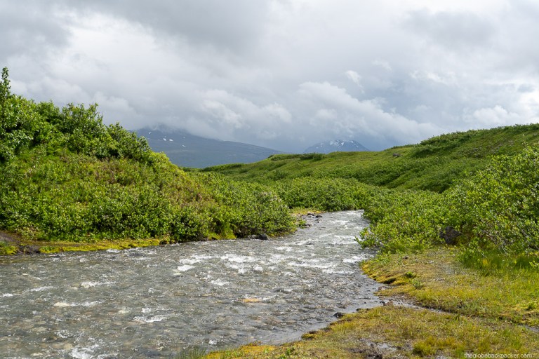
There are numerous creek crossings on the trail. But, only one of them, after 6 km, is a relatively large one where you’ll have to remove your shoes and cross. The trail ends soon after crossing this creek and you’ll have to make your own way to the glacier viewpoint on the remaining 4 km of the trail.

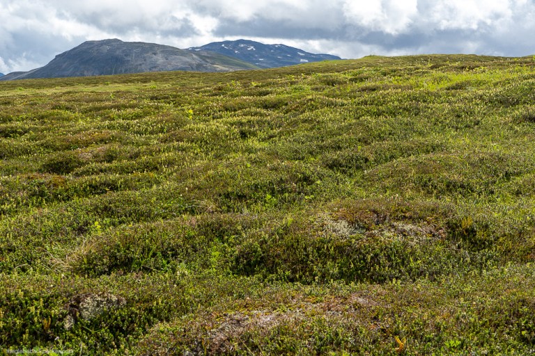
This section is very boggy; a subalpine terrain. As you’ll reach closer to the first hilly spot, you will get a very first glimpse of the glacier! This is a cool spot to soak in the views.

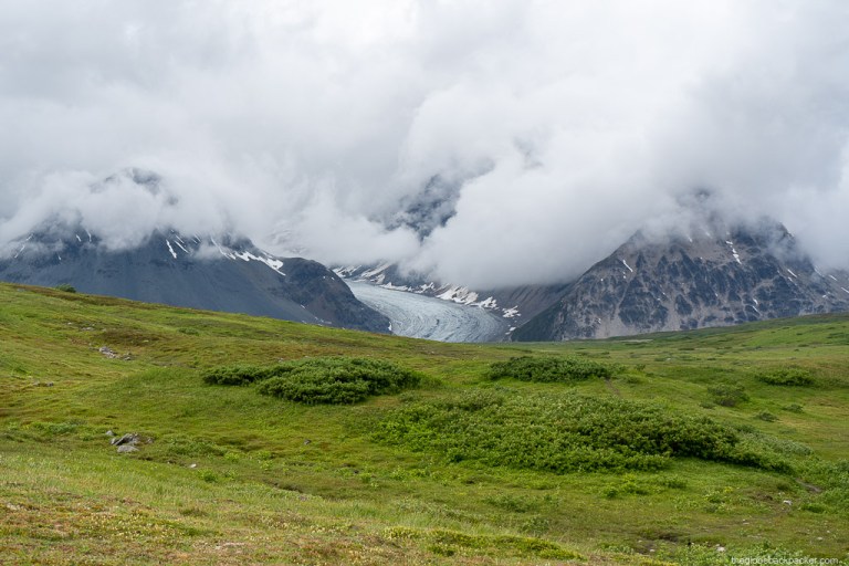

At this point, all of us were completely soaked and exhausted from a long hike and relentless rain. But, that didn’t stop us from going further. After all, you don’t get to cherish these views every day, eh!
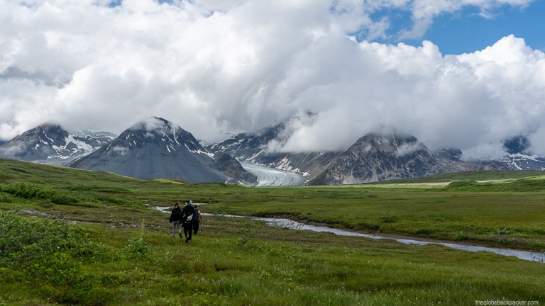
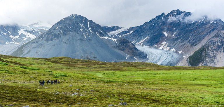
All this time, we had the entire trail for ourselves. At the very end, for the first time, we spotted another group, returning back. This is one of my favorite pictures of the entire hike. It illustrates the true scale of the glacier.

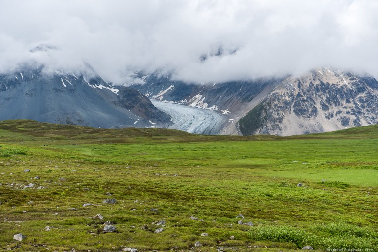
After another 15 minutes, you will reach on top of a small hill (behind the group of people in the picture above). From there you’ll get a completely different perspective of the glacier – the mouth of the glacier.

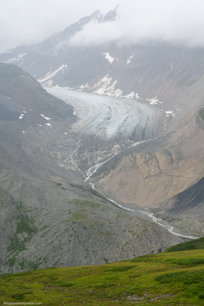
On far right, there is another section of this glacier. If time permits, you can hike for another 1-2 km to the mouth of that glacier as well. Unfortunately, the weather gods were against us that day and it began to rain again. Hence, we decided to head back to the trail head.

Overall, it was a spectacular hike, but for the weather. Pro tip: Check the weather forecast and plan to do this hike on a sunny or partly cloudy day.

Driving Directions
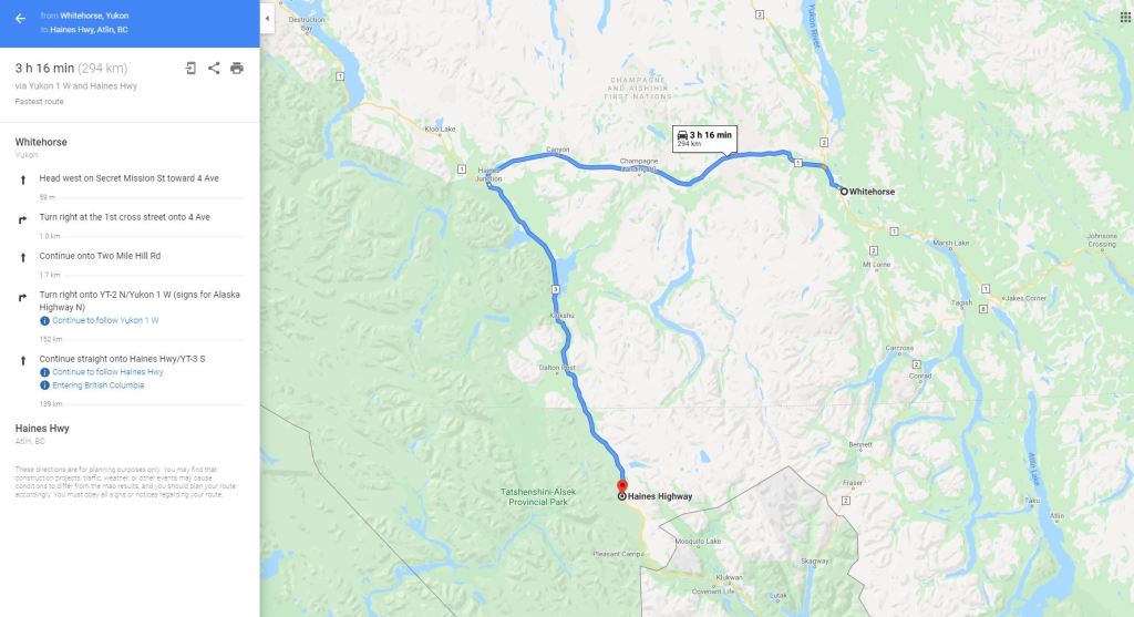
The Samuel Glacier trailhead is 294 km from Whitehorse downtown. To reach there, take the Alaska Highway to Haines Junction. From Haines Junction, get on to the Haines Highway (Highway 3) and continue south for another 139 km. The drive itself is very beautiful with jaw dropping scenery on either side.
Note: There are no services of any kind once you cross Haines Junction. Hence, fuel up and buy whatever is required before leaving Haines Junction.

6 responses to “Hiking the Samuel Glacier Trail in Tatshenshini-Alsek Provincial Park”
Hello, cool trip! Just wanted to let you know your photo of a “marmot” is actually a arctic ground squirrel, colloquially known as a gopher. There are hoary marmots in the area you visited but that is not one. Safe travels!
LikeLike
Thanks for correcting that. Good to have the facts corrected for other readers. Safe travels!
LikeLike
[…] Check out my experience of day hiking the Samuel Glacier here. […]
LikeLike
Great post. How was the trail post the 6km creek crossing? What degree of wayfinding skills would you say is needed?
LikeLike
Thanks!
It was pretty straightforward. Not much, assuming you’re going during Summer months. In winter months, with snow on the ground, it may be a bit challenging.
I’ve only been in summer, and can tell you that you will see the trail almost all the way. When the trail disappears, you’ll see the glacier in front of you. From here, you can pretty much make your own trail.
LikeLike
Great, planning for August. Appreciate you getting back to me
LikeLiked by 1 person