Note Friends: For a limited time (until April 4th, 2024), I’m running a fundraiser for a non-profit organization ’Planeterra’. Please help me support Planeterra by making a donation through my fundraising page.
Planeterra is a non-profit organization that supports multiple small communities worldwide by running various projects to empower the communities where G Adventure travels. More about Planeterra can be found on my page.
If you enjoyed reading this post and would love to make a small difference to the communities around the world. Even a small donation will help me achieve my goal! The process is fast, easy, and secure. Thanks so much for your support.
https://www.classy.org/fundraiser/5315896
Now back on to this post! Thanks & Cheers!
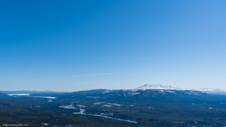
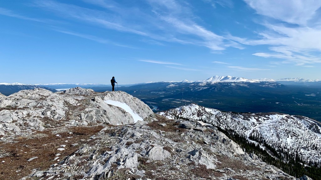
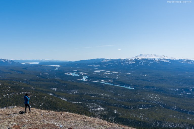
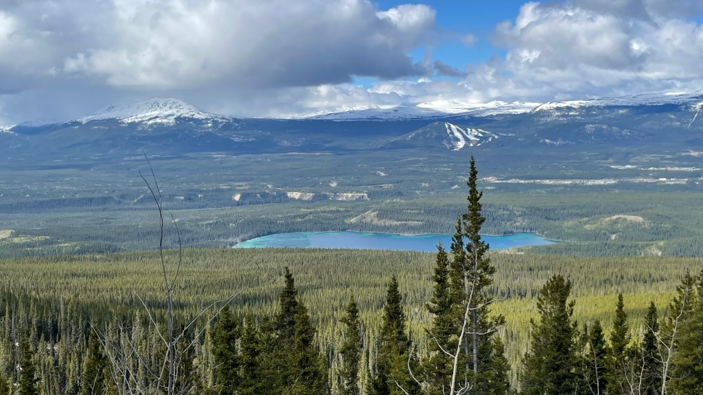
If you’ve been to Whitehorse, you must have seen the Grey Mountain, prominent over the city. It is even visible from the downtown riverfront. The one with a big communication tower near the Summit is the Grey Mountain.
It is one of the closest hikes from the town. You can actually bike to the trailhead, which in itself is an adventure.
| Type | Out & Back |
| Distance | 5.3 kms |
| Elevation Gain | 250 mts |
| Elevation | 1495 mts |
| Difficulty | Easy |
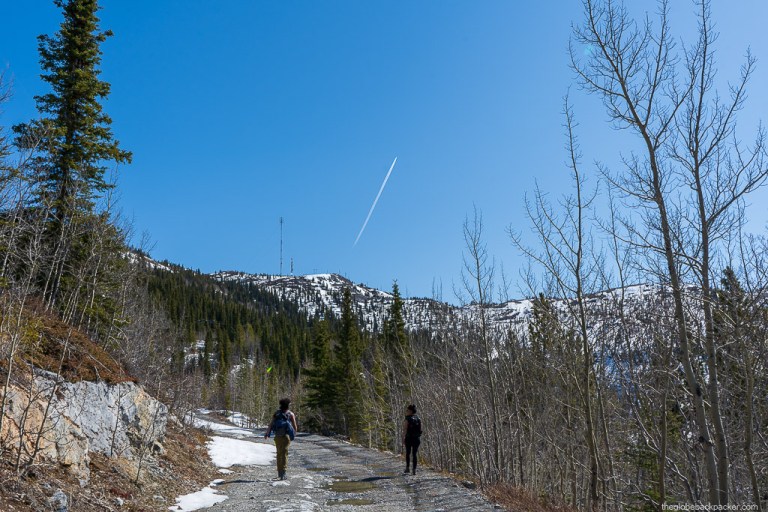

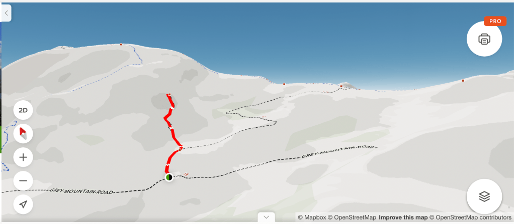
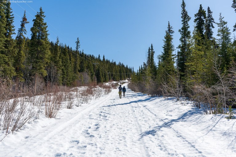
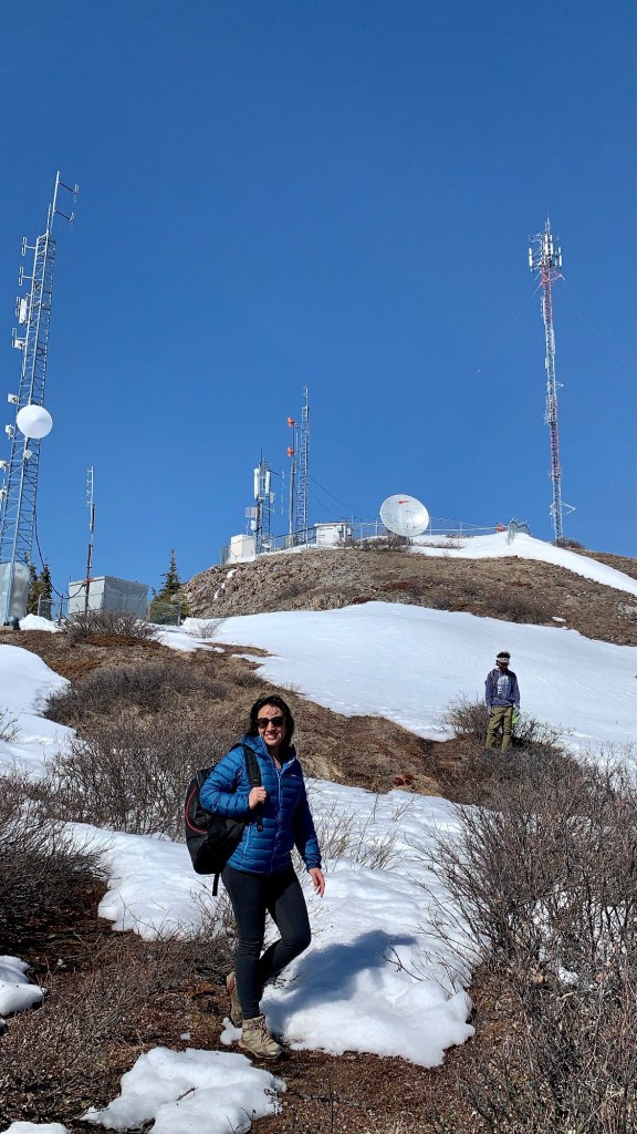
This hike is doable throughout the year. During the summer months, from May-Sep, you can drive all the way to the towers which is the actual trailhead. In winters, you will have to hike up to the towers from the parking lot at the base of the mountain, which may add another 5-7 kms depending on the snow cover and how much further up you can drive.
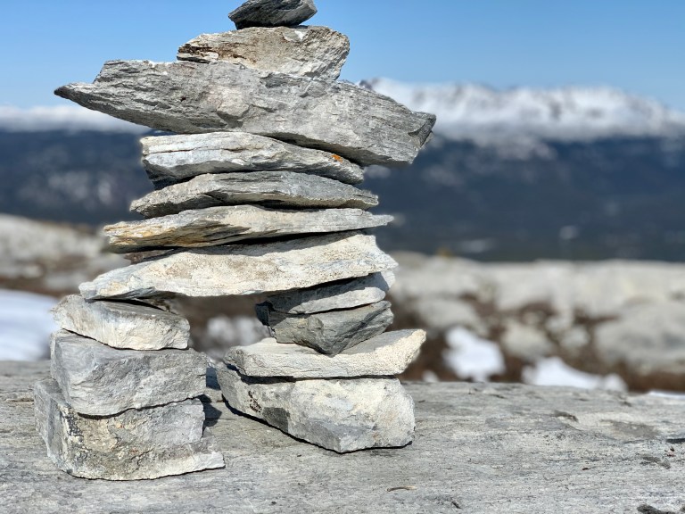
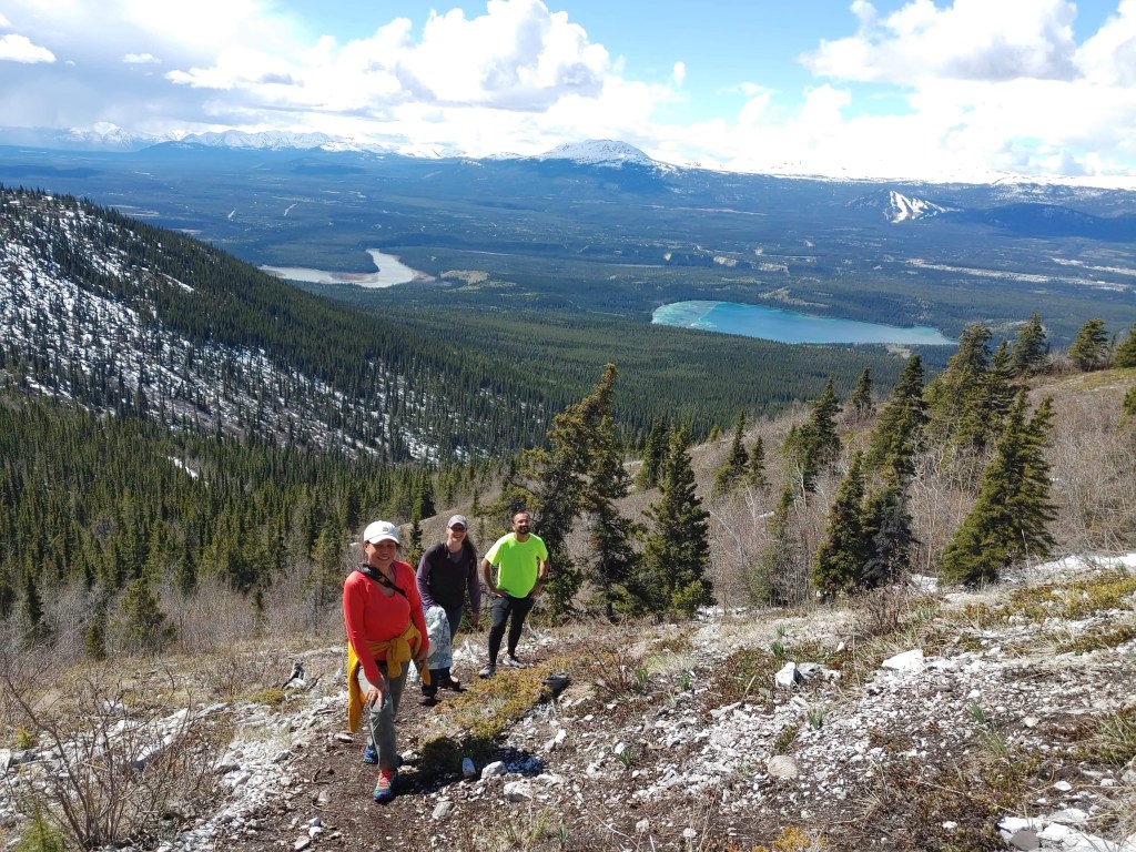
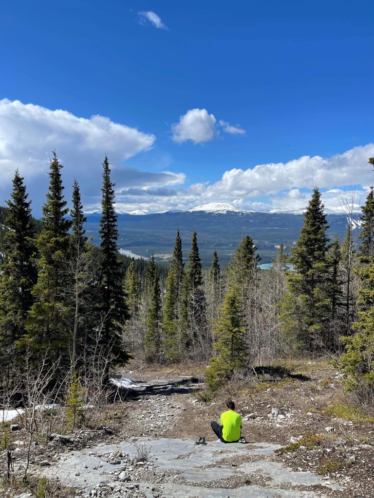
When you reach the trailhead, adjacent to the towers, there is a small trail leading north. You’ll also see a wooden mark ‘Grey Mountain Summit Trail’. If you follow along this trail, you’ll reach the summit in about 2.5 kms. The summit is usually marked with a rock cairn.
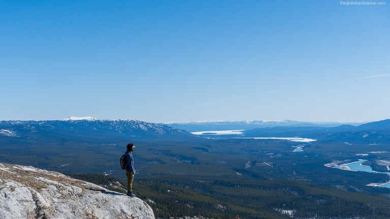
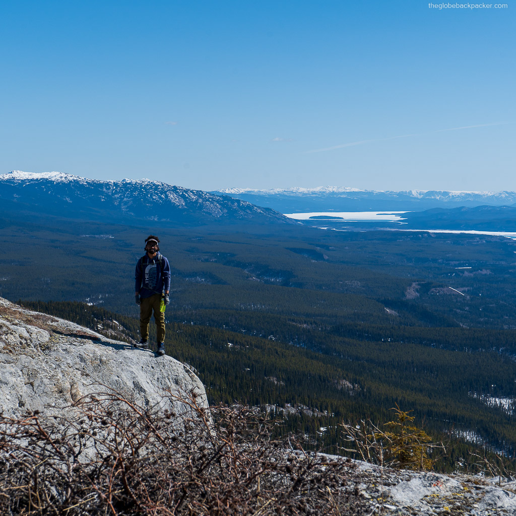

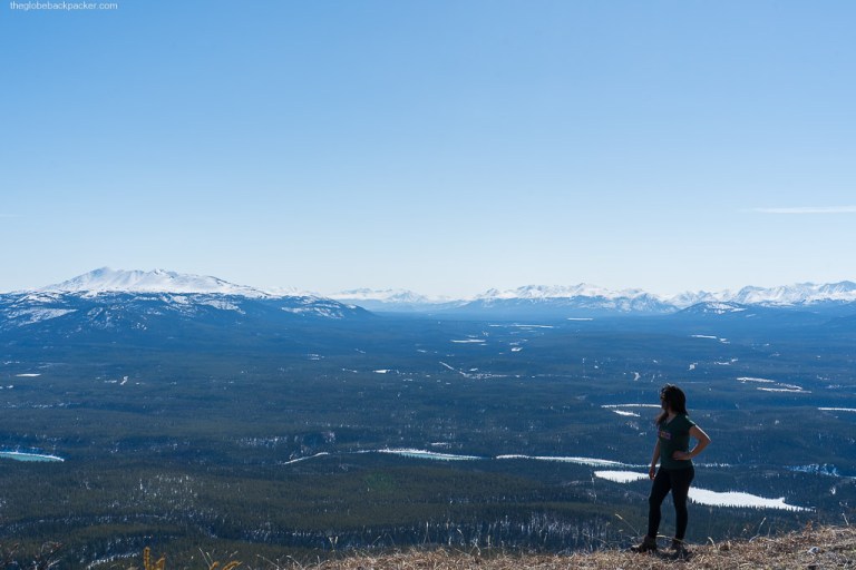
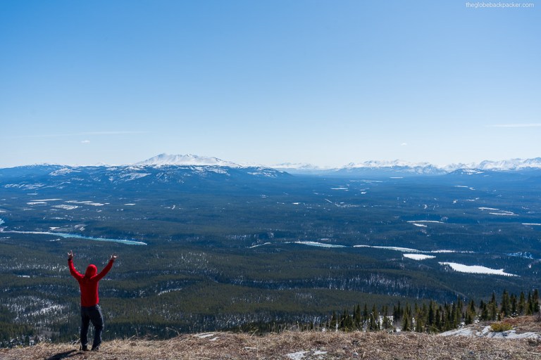
From here, you can continue further to the second and third summits. These summits are lower in elevation compared to the first, but offers better views of the city below.

In the winter months, this is also an ideal trail for Snowshoeing and front country skiing/snow boarding.
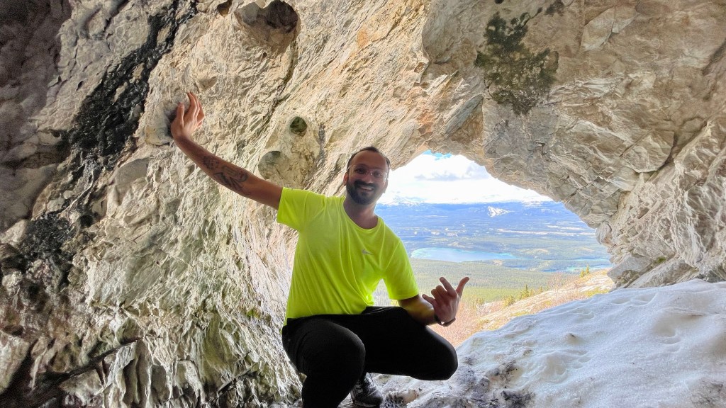
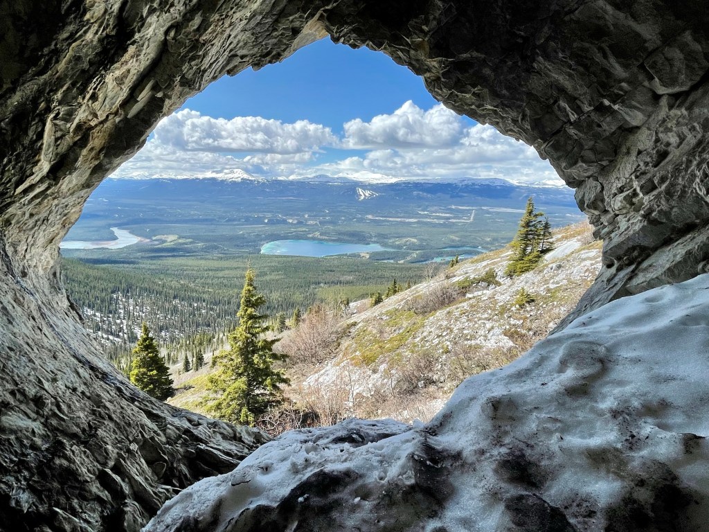
Exploring the Secret Cave
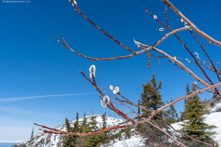
Another option on the Grey Mountain is to do the hike to the cave. It is a small hike (2 kms), but is very steep. The start of this hike is not far from the second parking lot while driving up to the towers. There is a visible rocky cutoff with a stream flowing down due to melting snow in spring and early summer.
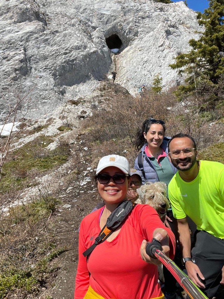
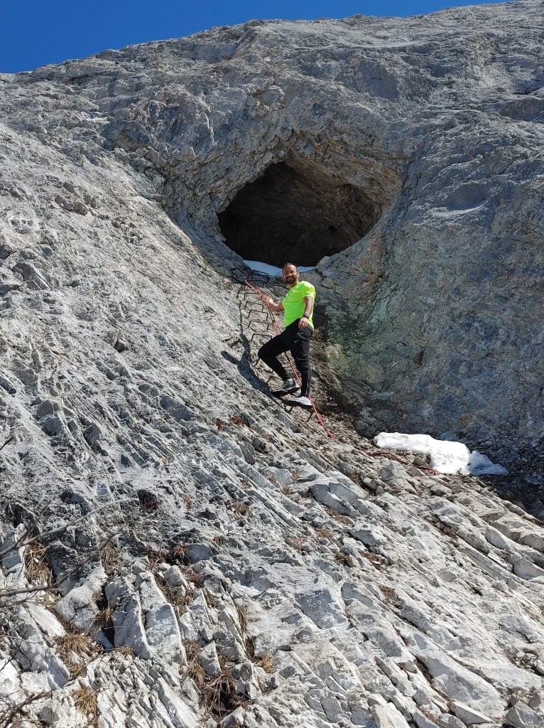
Most of the hike is climbing up the steep slope of the rocky face of the Grey Mountain to the cave. Final few steps to the cave are vertical and there is a ladder and rope to climb into the cave. It is an adventure worth every effort. The views from the cave are simply stunning.

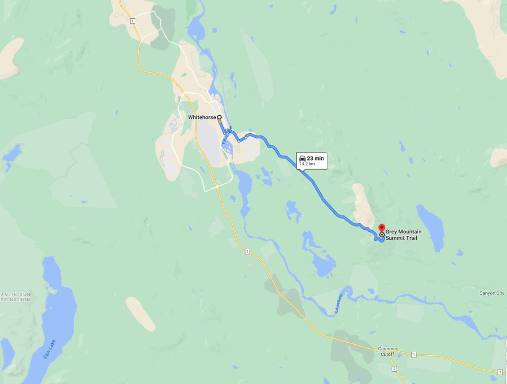
Driving Directions
Grey Mountain is the closest hike from downtown Whitehorse. You can see the mountain from the town. Given its close proximity, people often to do this hike after work as well. Hence, it can be a busy on any day of the week.
You will need either a 4WD or an AWD vehicle if you want to drive all the way up to the tower. After the parking lot at the base, it is considered off-road driving.