
Note Friends: For a limited time (until April 4th, 2024), I’m running a fundraiser for a non-profit organization ’Planeterra’. Please help me support Planeterra by making a donation through my fundraising page.
Planeterra is a non-profit organization that supports multiple small communities worldwide by running various projects to empower the communities where G Adventure travels. More about Planeterra can be found on my page.
If you enjoyed reading this post and would love to make a small difference to the communities around the world. Even a small donation will help me achieve my goal! The process is fast, easy, and secure. Thanks so much for your support.
https://www.classy.org/fundraiser/5315896
Now back on to this post! Thanks & Cheers!
M’Clintock hike is a very short hiking trail, just outside Whitehorse. But, don’t let the distance fool you. It is short, but very steep. Hence, it is an ideal trail for running and training.

| Type | Out & Back |
| Distance | 2 kms |
| Elevation Gain | 210 mts |
| Difficulty | Moderate |
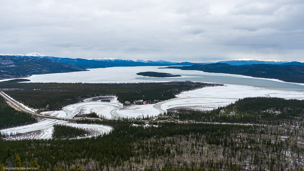
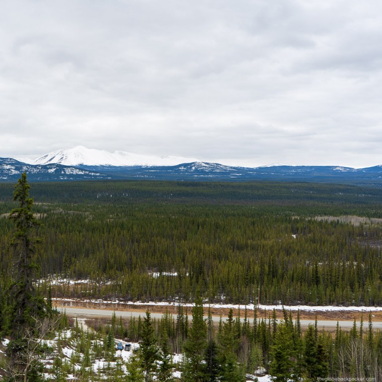
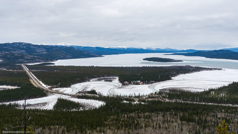
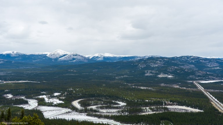
M’Clintock hike is a nice half day hike with panoramic views of the Marsh Lake and the starting point of the Yukon River.


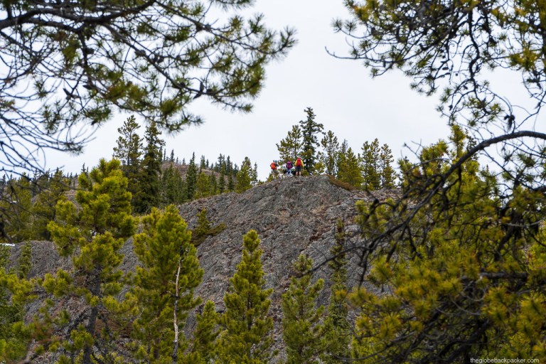
Despite of its short distance, this is a moderately rated hike due to the elevation gain. From the parking, you’ll begin to gain serious elevation right away. The initial half of the trail is pretty steep and it gains about 75% of the total elevation in that distance. After climbing this section, you’ll reach the first viewing platform.


From here, the trail kinda disappears. You’ll have to bushwhack and find your own way. There’s also a small rock scrambling section which will take you to the second lookout point.


After a small break and a hot tea, you can follow the same path back to the trailhead.
Driving Directions
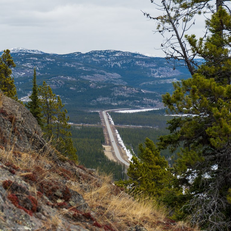
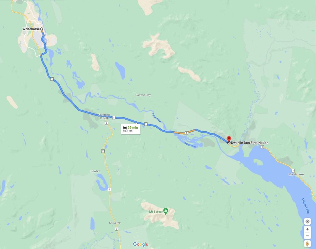
M’Clintock trail is located on the Alaska Highway, south of Whitehorse. It is opposite to the point where the Yukon River initiates from the Marsh Lake. It is 40 kms from Whitehorse and will take you about 30 mins to reach there.
If you’re hiking here in the Spring, there is a Swan Haven Interpretive Centre nearby, which is a terrific place to stop by and gaze at the Tundra Swans and the Trumpeter Swans on their migratory path north. Don’t forget your binoculars!
More Pictures


2 responses to “M’Clintock Hike in Whitehorse, Yukon”
Very nice. Keep it up. Good going.
Enjoy your hiking and exploring the nature.
LikeLike
Thank you !!
LikeLike